Development and Promotion of a navigation system for improving accessibility in urban environments (SDG#11)
Description
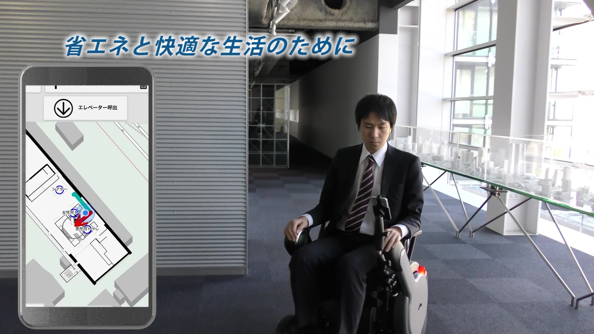
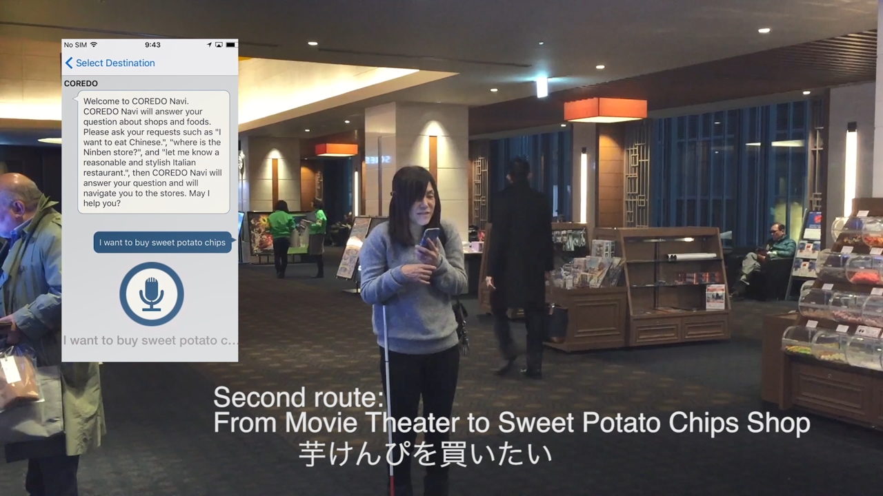
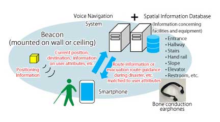
People with visual impairments and wheelchair users face various logistical challenges when they go to unfamiliar places. We have developed and are implementing a highly-accurate indoor navigation system to create an accessible urban environment for independent travel. The system consists of a smartphone app, sensors, and servers to navigate and provide information on the surroundings. This system was developed with generous help from many people with disabilities. We have piloted the system in multiple locations and we are now planning to expand the areas where the service is available in Japan and the US.
Independent mobility is an essential capability enabling people with disabilities to receive an education (Target 4.3), be gainfully employed (Target 8.5, 8.6) and become truly independent members of society (Target 10.2, 11.2, 11.7). Our ultimate goal is to allow people with various mobility challenges to be able to move around and enjoy the urban environment completely independently. We call this aspiration "real-world accessibility" and an indoor location technology is one of the critical components. People with visual impairments have difficulties with location awareness, direction and the surrounding environs. A wheelchair user needs to find an appropriate route which they can easily travel without encountering gaps, stairs and other barriers. Therefore, the system should be capable of sharing accurate location, direction, non-visual landmarks (sound, flooring material, etc.), gaps, steps, and other amenities around them such as shops, toilets, and other facilities. Our system aims at filling such needs by combining a new smartphone app to calculate the users location from sensors leveraging machine learning technology, a newly created geographical information database server, and a voice interface with flexible search features.
- Shimizu Corporation (Project leader, Installing the system into the buildings)
- IBM Research – Tokyo (Developing navigation system and localization technique)
- Carnegie Mellon University (User interface design and evaluation through pilots)
The project could not have implemented without collaboration with building and land owners. Their understanding and cooperation were key to the successful implementation.
- Mitsui Fudosan Co., Ltd.
- Chuo City Office
- Ministry of Land, Infrastructure, Transport, and Tourism
-We conducted several experiments and validated the effectiveness of the system to allow people with disabilities to travel alone while using the technology. Many people with disabilities including blind people, visually impaired people and wheelchair users are participating in this project and contributing to improving the user interface through feedback, experiments and open pilots. When we developed the first prototype of the system in 2015, we conducted the first experiment with ten visually impaired people to check the user interface of navigation application in Shimizu office. In 2017 we installed our system in a 21,000m2 area shopping mall at Nihonbashi Muromachi in central Tokyo and conducted the second set of experiments with over 50 people with disabilities to evaluate the effectiveness of the system to help their independent travel. We also released the navigation application to the public as an open pilot for one month and collected valuable opinions on the effectiveness of the system. We started a third set of experiments at another public building in Tokyo, Toyosu Civic Center, in 2018 and added the multi-language function to assist foreigners. We conducted several tests at other hotels, schools, and airports in the US and continuously improved the app. The navigation application, NavCog, was released in English, Japanese, Korean and Simplified Chinese in September 2018 free of charge(Our project website at Carnegie Mellon University http://www.cs.cmu.edu/~NavCog/navcog.html)
. It will soon be used in large transportation facilities and complex underground arcades in Japan and hospitals in the US as we continue to expand the coverage of the system.
Many participants in our experiments said they hoped to go to various places such as shopping malls, amusement parks and museums by themselves but they need the information on their surroundings that our navigation provided. We are confident of the usefulness of the navigation system for improving the accessibility of urban areas, "real-world accessibility" and are sharing this experience with the public through various channels including academic papers. (The details are described in “other sources of information”). Such activities have raised awareness of the challenge of independent mobility, especially in Japan, and have accelerated multiple initiatives including a Japanese government committee for accurate indoor localization.
Our navigation application is open-sourced. Everyone can participate in our project and develop the navigation system, expand the database of necessary information for people with disabilities and spread the coverage of the system. We continue to recruit members through various channels to make our project available worldwide.
It is crucial to create a business model for location information for a sustainable navigation system. The voice navigation system is just one of the various services using location information. Other uses include building management, emergency calls and people flow analysis for market research. We will try a create business model to enable us to continue providing our location positioning infrastructure for helping people with disabilities and other difficulties free of charge.
Mobility is a crucial capability for people with disabilities to receive an education, join the workforce and improve the quality of their daily lives. Our urban environment is challenging for them with complicated routes, gaps, barriers and lack of information sources. This project aims at developing a new indoor off-the-shelf smartphone navigation technology providing necessary information to help people with disabilities move independently and enjoy the urban environment. We were supported by many people with mobility disabilities throughout the development and expansion process. We now continue to actively promote the project, share our new knowledge and the benefits of navigation technology, and expand the areas where the system is installed. We learned it is crucial to cooperate with the key stakeholders including building and land owners, town planners and construction companies. They must all be involved and help coordinate activities. <br />
During the development process, we received many positive comments from participants during feedback sessions. One blind person said, "I feel I can walk alone in unfamiliar shopping malls, schools, and stations." We are still on the way to fully realize this dream, but we believe this project is one of the important milestones to create a truly accessible urban environment.
- Field experiment in Nihonbashi, Tokyo (Feb 2017)
https://www.youtube.com/watch?v=mlGcutE2t2A
- NavCog at Annual PCB Conference
https://www.youtube.com/watch?v=KkRigGqTsuc
Press release - (Jan. 26, 2017, in Japanese),
https://www.shimz.co.jp/company/about/news-release/2017/2016046.html
- Seamless Voice Navigation, Indoors and Outdoors (Jan. 26, 2019)
https://www.shimz.co.jp/en/company/about/sit/topics/topics03/
Our project website at Carnegie Mellon University
- http://www.cs.cmu.edu/~NavCog/navcog.html
Academic papers and presentations in conferences
- Daisuke Sato, Uran Oh, Kakuya Naito, Hironobu Takagi, Kris Kitani, Chieko Asakawa: “NavCog3: An Evaluation of a Smartphone-Based Blind Indoor Navigation Assistant with Semantic Features in a Large-Scale Environment”, ASSETS '17 Proceedings of the 19th International ACM SIGACCESS Conference on Computers and Accessibility, Pages 270-279, 2017
- Murata Masayuki, Kakuya Naito: “Fine-grained Indoor and Outdoor Navigation System for the Blind”, CSUN2016
Articles
- The new app that serves as eyes for the blind, Oct. 22, 2015, Washington Post.
https://www.washingtonpost.com/news/innovations/wp/2015/10/22/the-new-a…
- Realizing a barrier-free society, Feb. 14th, 2017, IBM Research Blog
https://www.ibm.com/blogs/research/2017/02/realizing-a-barrier-free-soc…
SDGS & Targets
Deliverables & Timeline
Resources mobilized
Partnership Progress
| Name | Description |
|---|
Feedback
Action Network


Timeline
Entity
Region
- Asia and Pacific
Geographical coverage
Photos


Website/More information
Countries

Contact Information
Tomoyuki Motiguchi, None
